In the aviation world, they don’t use AM/PM times. Instead, all times are assumed to be AM unless they’re labeled NOTAM.
You must log in or register to comment.
So I actually went and tried to decode this because I was horrified that I didn’t understand half of this. Turns out I don’t usually see freedom units or volcanic ash tornadoes.
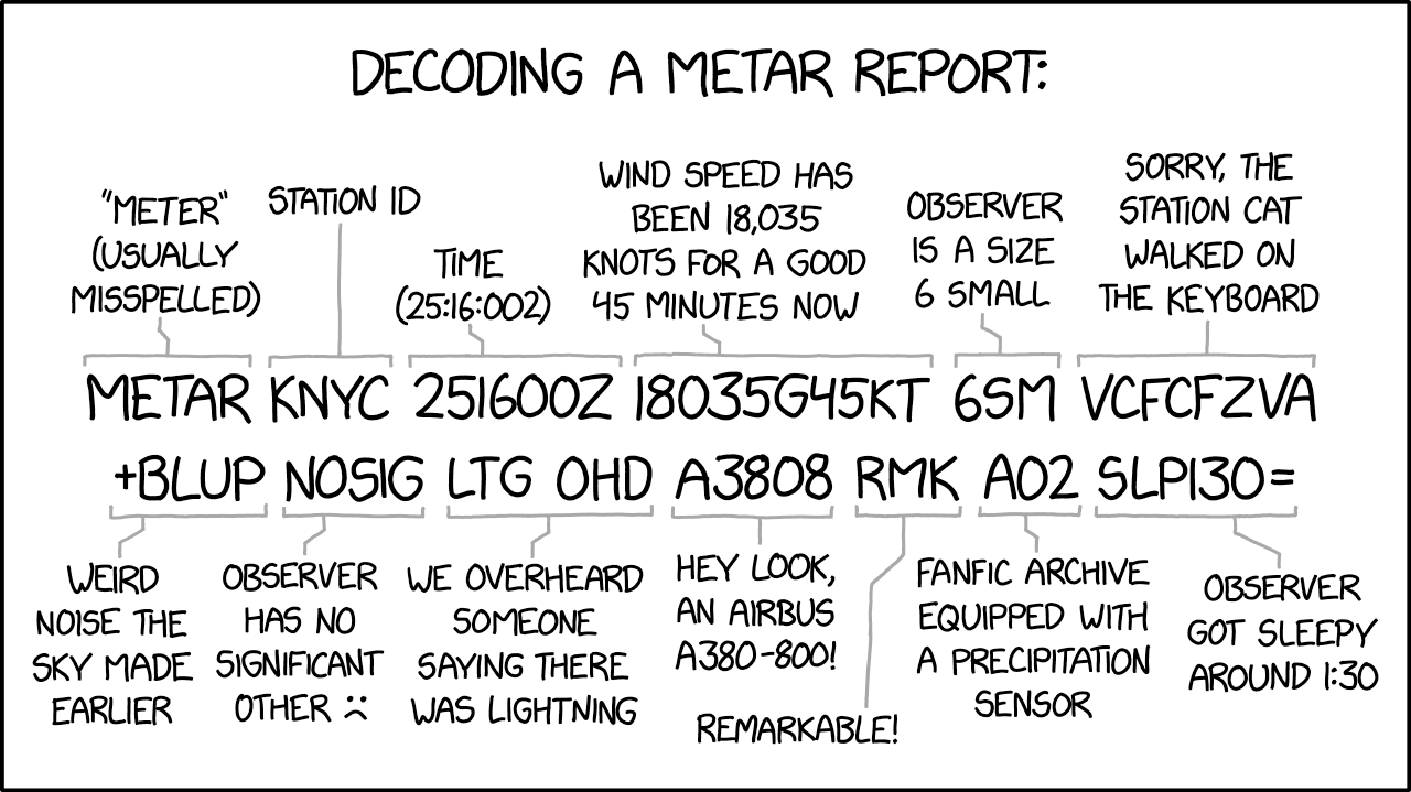
- METAR - That’s just specifying this is a meteorlogical report as opposed to something else like a TAF or a NOTAM
- KNYC - This should be the airport the report is given for, KNYC doesn’t exist, but if it did, it would be somewhere in the US since it starts with a K
- 251600Z - means the report is dated for the 25th, 16:00 UTC
- 18035G45KTS - this is the wind, coming from 180 degrees, 35 knots gusting 45, so a lot of wind
- 6SM - so this was weird, but it’s just US weirdness, visibility 6 statute miles, so equivalent to the 9999 message everywhere else
- VCFCFZVA - in the vicinity funnel cloud, freezing, volcanic ash (freezing volcanic tornadoes, yay!)
- +BLUP - heavy blowing unknown precipitation, so a lot of something coming your way
- NOSIG - no significant change expected, this is your life now
- LTG OHD - surprisingly accurate, lightning overhead
- A3808 - again, weird US shenanigans, altimeter setting 38.08 inches of mercury, which is not really consistent with that major storm but I digress
- RMK - remarks, this is how meteorogists say “oh, by the way”
- A02 - I’m an automated weather station who also can differentiate precipitation (pretty high strung for someone who just announced +BLUP)
- SLP130 - sea level pressure is 1013 hPa, which means that this airport is at around 2100 m above sea level
The altimeter setting should be referenced to sea level as well. Which means it doesn’t agree with the SLP.
I was giving a benefit of doubt and assuming it must be a QFE setting or IDK.
38.08 is veery high for a QNH anyways
As someone who can actually read METAR, my frontal lobe is currently in agony.


