

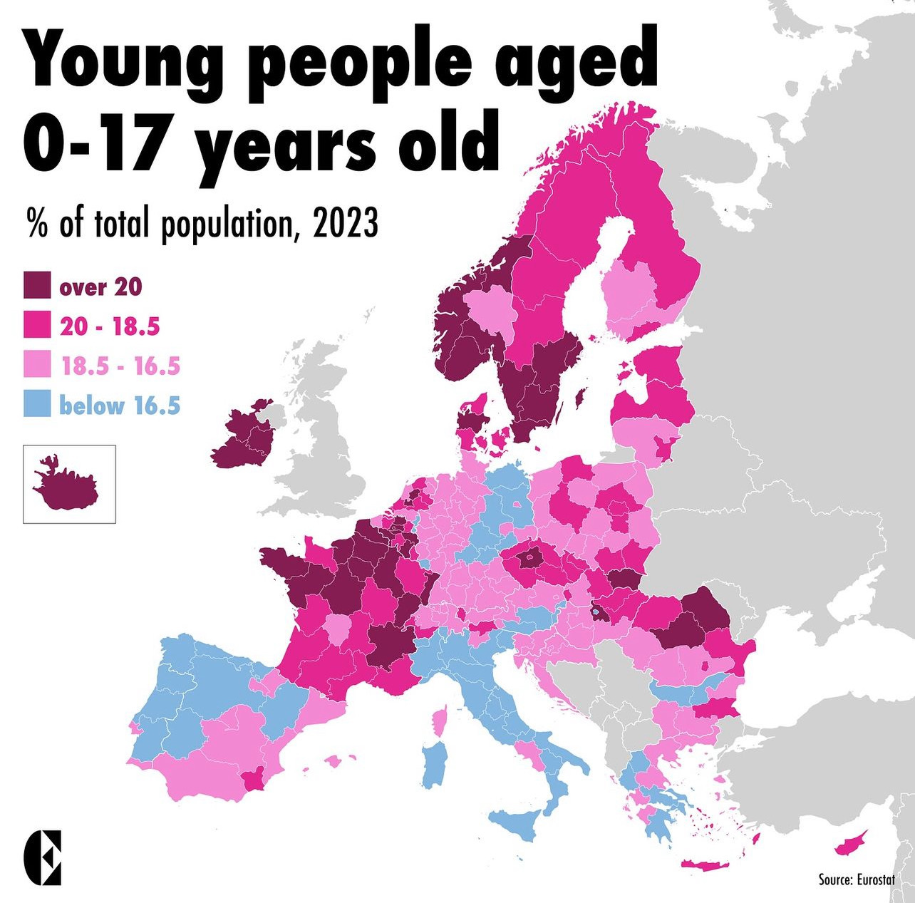
This map shows the percentage of the population aged 0-17 years. In order to be able to identify differences within countries, the map shows the differences at a regional level.
Source: Eurostat
Are you surprised how many or how few children there are in a region in Europe?
please show me a similar statistical map where you can see no difference between east and west Germany :-( i think German reunification did not work out as intended, many mistakes were made…
You can also clearly see the shapes of Saxony and Thuringia. But something is wrong in Oberfranken and Unterfranken…
Oh it sadly was intended that way. Nothing was united. It was just annexed and scolded.