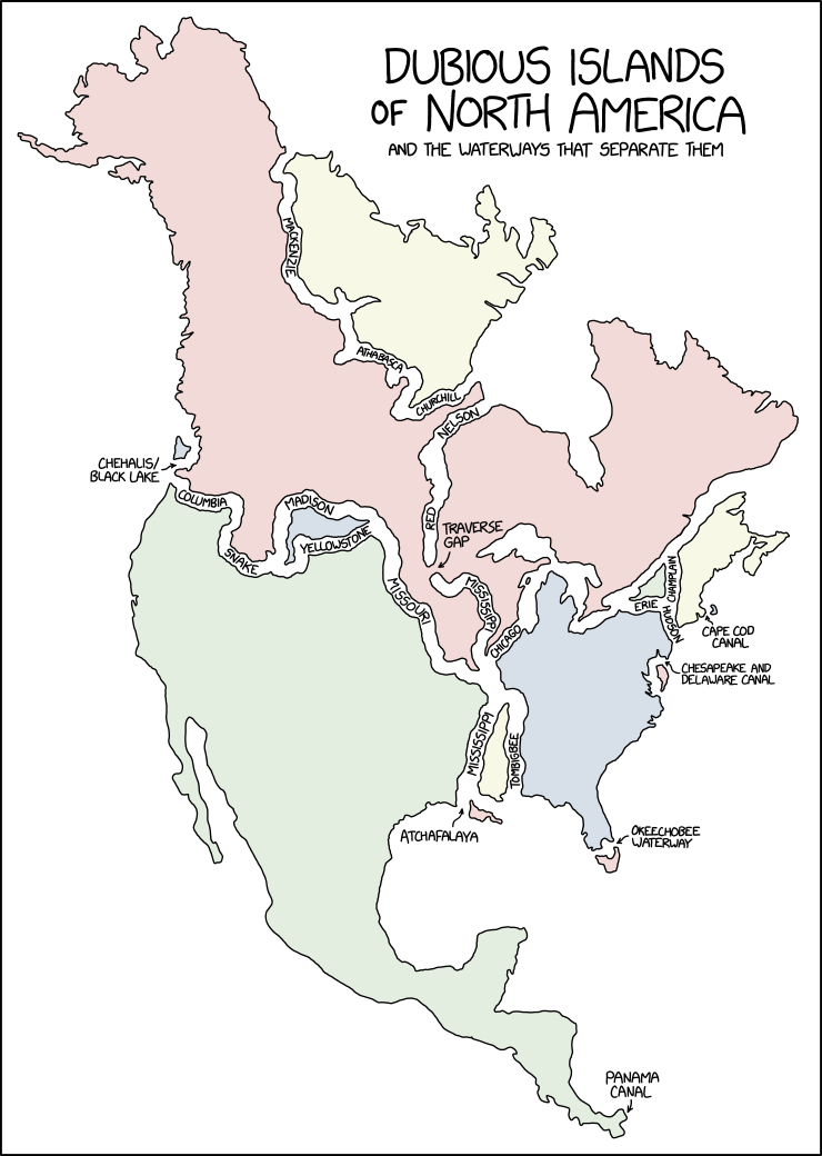
Running for office in Minnesota on the single-issue platform ‘dig a permanent channel through the Traverse Gap because it will make this map more satisfying.’
Fun fact, that traverse gap separates the red river of the north from the MINNESOTA river - which eventually drains into the Mississippi. The Mississippi starts at Lake Itasca.
Fun fact #2, the Minnesota/Mississippi drains into the Atlantic via the Gulf, but the red river eventually drains into the Arctic Ocean via the Hudson Bay!
Another fun fact; the Red River is very prone to spring flooding because it flows such a great distance north. The headwaters thaw out and start flowing while the river’s outlet is still frozen over. Many cities and towns in Manitoba have dikes around them and turn into islands during the spring flood. Winnipeg has a flood diversion canal to guide the floodwaters past it each spring.
I think I just ran out of fun facts about Manitoba.
I wonder if they were connected, hypothetically, if the Hudson would drain into the Caribbean or the other way around. The North American plains bisect the entire continent so it’s feasible; I just don’t know if the two bodies of water are at the same elevation, and due to gravitational effects, etc, large bodies of water aren’t always at sea level.


Alt-text OP inexplicably refused to give us:
I deserve this, even promised to remember last time
I will await you’re return with an upvote in hand
Fun fact, that traverse gap separates the red river of the north from the MINNESOTA river - which eventually drains into the Mississippi. The Mississippi starts at Lake Itasca.
Fun fact #2, the Minnesota/Mississippi drains into the Atlantic via the Gulf, but the red river eventually drains into the Arctic Ocean via the Hudson Bay!
Another fun fact; the Red River is very prone to spring flooding because it flows such a great distance north. The headwaters thaw out and start flowing while the river’s outlet is still frozen over. Many cities and towns in Manitoba have dikes around them and turn into islands during the spring flood. Winnipeg has a flood diversion canal to guide the floodwaters past it each spring.
I think I just ran out of fun facts about Manitoba.
Funny, I thought the Red River drained into Fargo.
I wonder if they were connected, hypothetically, if the Hudson would drain into the Caribbean or the other way around. The North American plains bisect the entire continent so it’s feasible; I just don’t know if the two bodies of water are at the same elevation, and due to gravitational effects, etc, large bodies of water aren’t always at sea level.