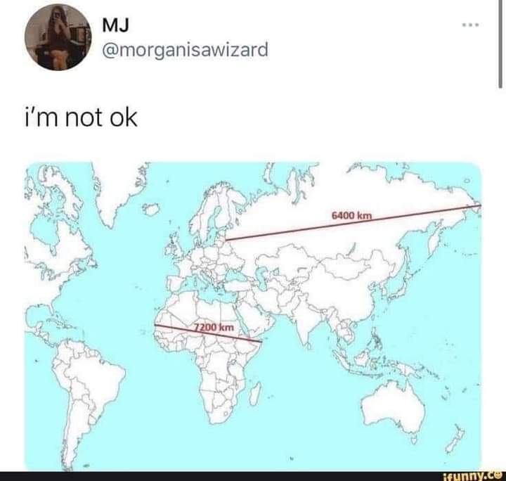
Effectively no. Any projection of a spherical surface into 2D will distort it in some way. If I understand correctly, the Mercator projection (which I think is what we’re looking at) is a cylindrical projection, which preserves latitude but severely distorts longitude near the poles.
I do know that aeronautical charts are conical projections, which is fairly distortion free for the relatively small area they cover, but you can’t lay more than a few of them edge to edge before things stop lining up.
You have distort some thing. Scale or directions. The one most people use keeps directions constant. Ie a 45 degree line between North and east will akways point due northeast no matter where it is.
Contrast that with a map that cuts out large triangle sections or naos that have tge equator wider then poles. These maps make true northeast variable.
deleted by creator