- cross-posted to:
- [email protected]
- cross-posted to:
- [email protected]
cross-posted from: https://sh.itjust.works/post/1641859
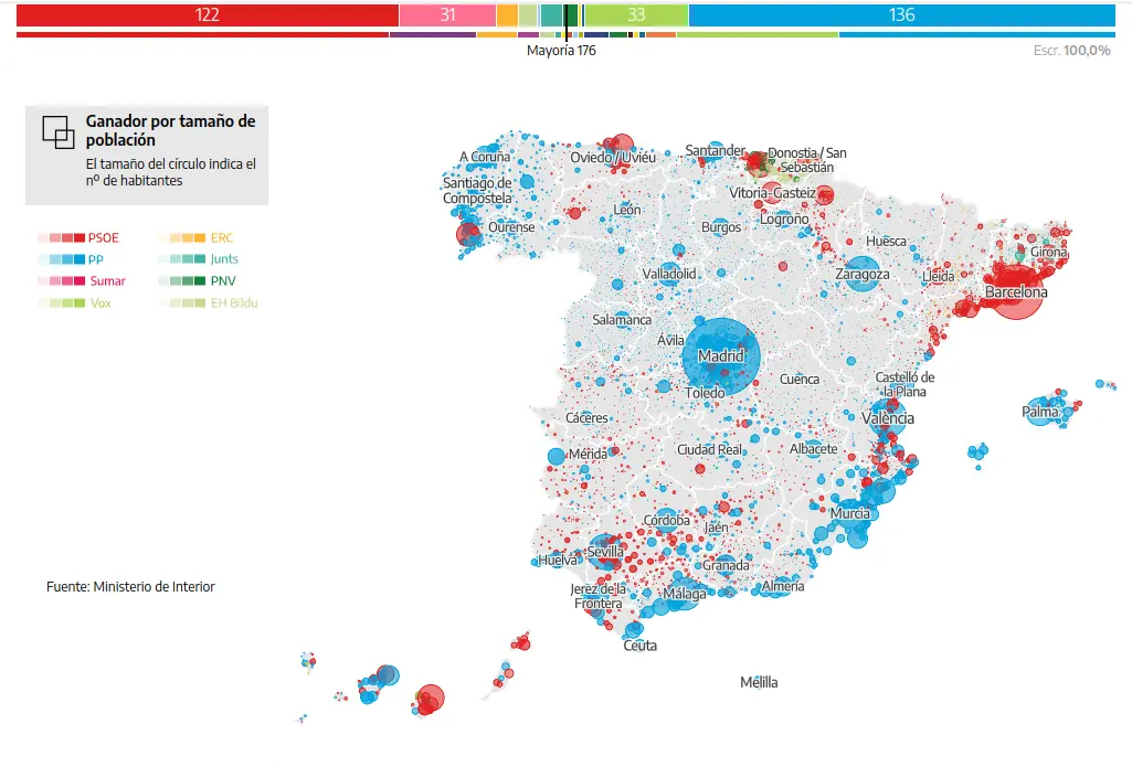
Since land does not vote, it is also useful to look at this map with population size indicated:
Taken from El Diario, with interactive maps and more: https://www.eldiario.es/politica/resultados-elecciones-generales-23j-por-municipio_1_10377802.html


deleted by creator
Actually, it’s not that polarized, when you look in details, a lot of places that appear blue still have a strong red result.
Yes, but if you look at the number of voters, the southwest, more left leaning, is heavily more unpopulated than the other regions like Galiza (northwest)
Indeed, actually an interesting map on this is “Ganador por tamaño de población” (third option on the left) on https://www.eldiario.es/politica/resultados-elecciones-generales-23j-por-municipio_1_10377802.html
Basque Country still seems quite red