
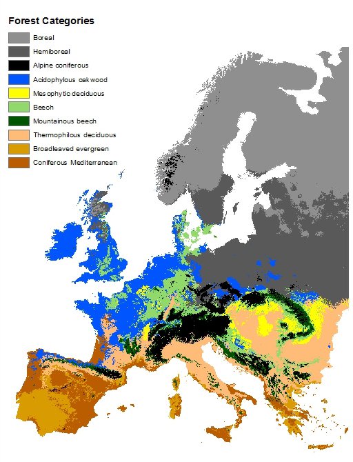
More info about the map and the forest types here. The forest types are described in chapter 6.
The map does not necessarily show what kind of forest actually grows in different places, if any, but rather which forest type you could expect to find there naturally, if it would be forest. But it probably matches reasonably well with what actual forests look like, although most of Europe is of course not covered by forests.
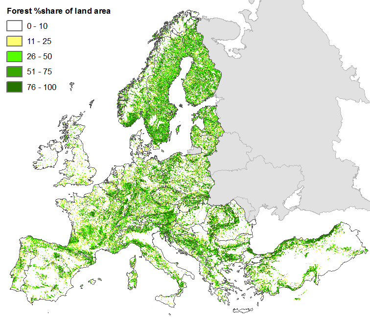
Here’s a map over forest cover in Europe:
You must log in or register to comment.
But it probably matches reasonably well with what actual forests look like
Nah, Germany has almost no natural woods, almost everything is planted for harvesting.
Which up until recently was mostly fir. The recent droughts are forcing them to plant other (non native) trees though
I found this map of dominant tree species in Germany while investigating it:
https://atlas.thuenen.de/layers/geonode:Dominant_Species_Class
Indeed, there is are significant difference between the maps. Perhaps most notably in Baden-Würtemberg where there seems to be a lot of fir. But I also think there is a a clear correlation between the maps. I also find it interesting to see the correlation between the suitable habitat for oakwood and the absence of forests.
Also in the Sauerland in the northwest of Germany where there should be oak or beech, it is often sprouce (or since a few years dead sprouce).
Nice. It also shows mountain ranges, Pyrenees, Massif Central, Dinaric Alps, etc.