
- cross-posted to:
- [email protected]
- cross-posted to:
- [email protected]
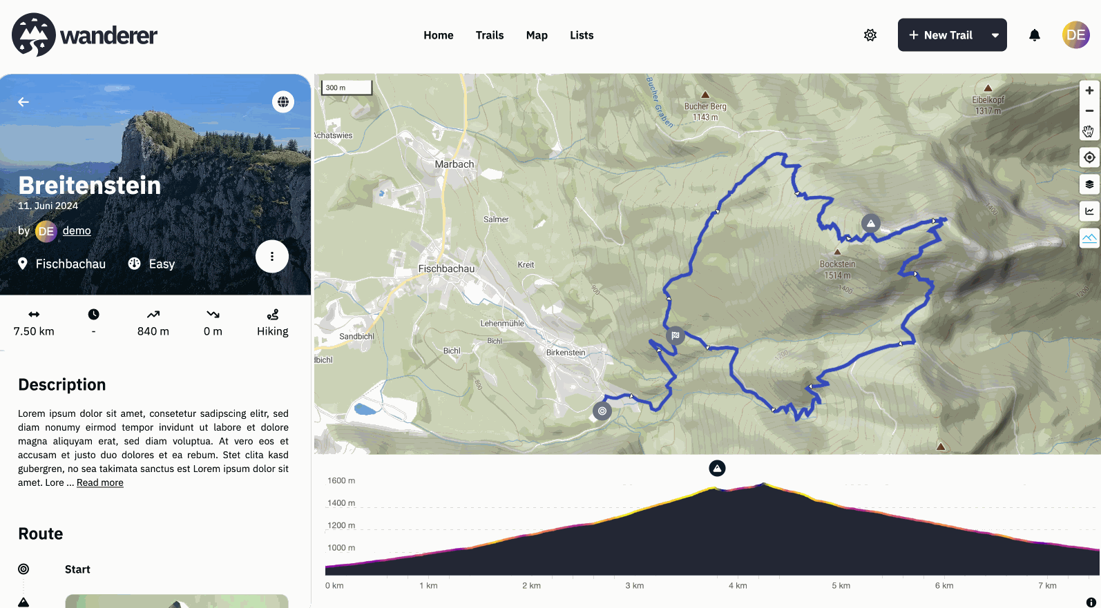
Hey everyone, #What is wanderer? wanderer is a self-hosted GPS track database. You can upload your recorded GPS tracks or create new ones and add various metadata to build an easily searchable catalogue. Think of it as a fully FOSS alternative to sites like alltrails, komoot or strava. #What is new? I’m coming back here to tell you a bit about what has been happening since my last update. Since then, we implemented some highly requested features:
- A fancy new 3D model on the front page (there is an easter egg, can you find it?)
- wanderer now uses vector map tiles which results in a significant performance boost for everything map-related
- As a result, we now also support topographical 3D maps in wanderer (see gif)
- Greatly improved social features: from list sharing, over profile pages and activity feeds to notifications
- The better location search allows you to search right down to the address
- And finally probably the most requested feature: integrations. You can now sync all your trails from strava and komoot directly with wanderer without having to manually export/import them
Big thanks to everyone who contributed code or translations! If you have any suggestions/questions feel free to let me know below.
Have a great weekend!
Flomp
- Github repo: https://github.com/Flomp/wanderer
- BuyMeACoffee: https://buymeacoffee.com/wanderertrails
- Docs: https://wanderer.to
- Demo: https://demo.wanderer.to
I want to try this. I’m one of the unfortunate victims of Gaia GPS turning to trash.
However, I can’t seem to find in the docs how tracks can be recorded…
Is there an app?
Do I need to be in contact with the server to record a track?
Do I need to ask my friends to send me gpx exports if they aren’t on strava?
Do you envision an integration with opentrailmap so in can share trails without having to expose Wanderer to public?
Recording is currently not possible with wanderer itself. I personally use osmAnd to record my trails and import them into wanderer. If you don’t want to expose wanderer to the public your friends would need to send you their trails, yes. But I guess that’s no different with any other service.
So I went to the demo and I have a few questions:
haystack-mountain-101522-105940.gpx
{"message":"TypeError: Cannot read properties of null (reading 'id')"}
I am actually really impressed with what you have so far, and I’d love to start using this!
There’s also a more lightweight alternative for recording tracks called OpenTracks. It can export the data in KMZ, KML, GPX or CSV format.
Ok, I think I can deal with recording on an OSM client. I’ll give Wanderer a try.
You might want to check out https://gpslogger.app/ for logging. I’m super happy with the battery usage. My use case is on multiday tracks, so battery charge is a luxury.