
- cross-posted to:
- [email protected]
Cross-posted from:https://feddit.de/post/10664616
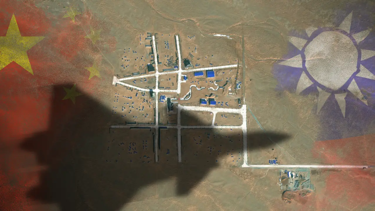
The satellite images reveal a layout of streets strongly resembling the Bo’ai Special Zone, a restricted area in Taipei’s Zhongzheng District that houses Taiwan’s most important state buildings, including the presidential palace, the supreme court, the ministry of justice and the central bank of Taiwan.
The Bo’ai Special Zone is subject to specific regulations, including a strict ban on overflight.
Based on the shadow, I’m assuming the plane that took these photos is approximately 3 miles long.
It’s funny that someone felt the need to add it and therefore made it look much more unrealistic and fake
Hey, it is noted in the article that this is a satellite image, and I don’t see the plane anywhere in the shot. So either:
A) The plane is above the satellite, which probably would require an even larger plane to cast such a deep shadow effectively,
B) The plane is far away horizontally and actually bigger than the estimated 3 miles length to compensate,
C) It is just a simple scaled down cardboard replica with someone’s kid’s platic toy plane casting a shadow on it,
D) It is a big Chinese Dickbutt drawn to imitate a plane’s shadow so that the photographing satellite would say “oh shit” and look over its shoulder, as part of the prank,
Edit: E) It is an Arma map with some Arma dude using setObjectScale script on the plane and taking a screenshot.
Definitely D.
That’s what she said.
Always the D.
Don’t be ridiculous
It’s just really close to the sun
It’s the shadow of the pope posing Marylyn Monroe style above a city drain vent.