
If you haven’t visited Israel or the Gaza Strip or spent much time thinking about their geography, it can be hard to understand how compact they are and how violence in one spot can feel immediate and personal throughout the area.
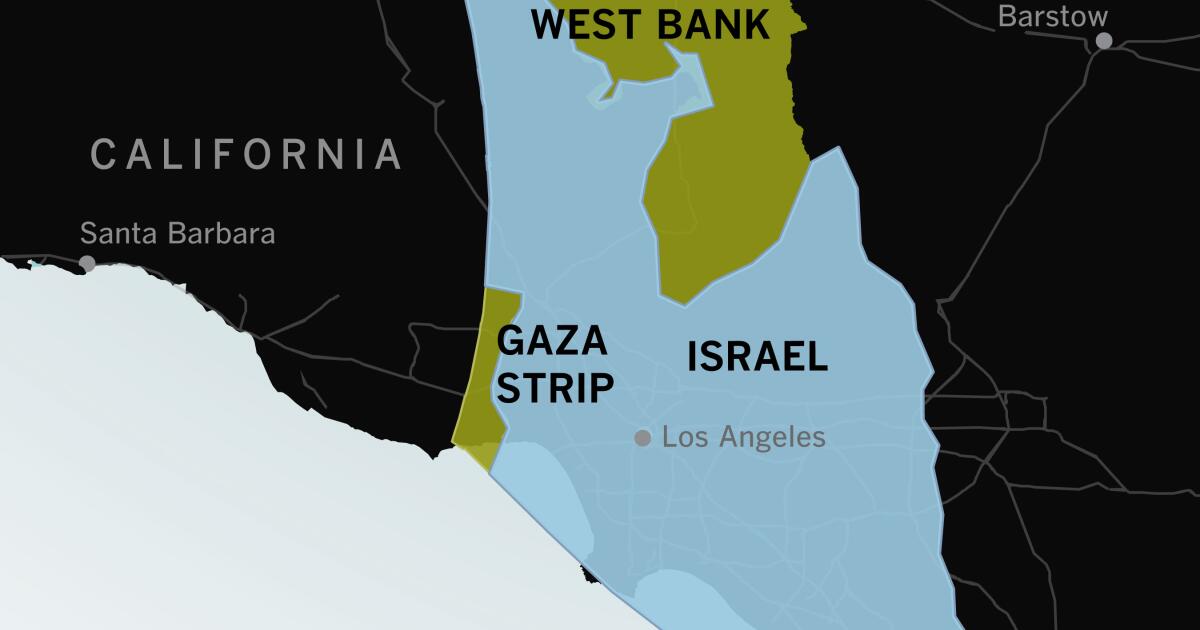
Maps of the region often look like this: Israel fills the frame. To people who are used to looking at maps of the United States, there seems to be plenty of space between major cities.
Now do it for areas that people not in the LA area will understand.
To be fair, the article is from the LA Times. Maybe your local newspaper can do a similar comparison.
thetruesize.com
(e: if anyone else is having an issue getting rid of the “how it works” pop up, once you type in and search for a country it refreshes and the x becomes clickable)
Putting it over Florida illustrates it much better, I think
Or the northeast corridor.
The length of Gaza is less than the distance from DC to Baltimore.
Funny easter egg, if you write your mom it takes up the whole map.
Israel is slightly larger in both size and population than New Jersey. Gaza is about twice the size of DC, with about 2.5 times the DC population.
The whole shootin’ match would fit inside the state of Pennsylvania
Stories like this are why I pay for an LA Times subscription. Support local newspapers!
I’m trying to keep up my subscription, but the coverage has just gotten more and more superficial. I understand it’s a question of $$. Still, makes me sad what we have lost as a society.
A 6 hour drive, top to bottom, would be about the same as the Southern Oregon border to Seattle. 3 hours to Portland, 3 hours to Seattle.
Likewise, about 6 hours to drive from the West Coast of Washington to the eastern border. So Israel is about an tall as Washington State is wide.
So it’s like if a fascist group seized control of Vancouver island and started lobbing rockets while Hezbo-Idaho invades from the east
Potato rockets from Idaho, yes. Also, Northern Idaho is practically a terrorist state anyway with its history of KKK enclave and, well, general elected officials.
About the southern part of Des Moines to the north suburbs of the Twin Cities. Super narrow though, barely anything off of the interstate. Much smaller than Minnesota.